Oceanwise Logo
LinkedIn Logo Twitter Logo
Log into Port-Log.net
Contact Page
+44 (0) 1420 768262
    • Home
    • About
      • About Us
      • News & Views
      • Events
      • Newsletters
      • Partners
      • Customer Case Studies
      • Professional Bodies
      • Our Team
      • Our Sustainability and Environmental Goals
      • Careers
      • Contact Us
    • Sectors
      • Overview
      • Ports and Harbours
      • Maritime Pilotage
      • Offshore Renewables
      • Governments and Agencies
      • Customer Case Studies
      • Data as Infrastructure
    • Compliance
      • Compliance Overview
      • Marine Data Management
      • Asset Management System (AMS)
      • Aids to Navigation Management System
      • Conservancy Management
      • Spatial Data Management & GIS
      • Environmental Monitoring
      • Our Courses
    • Monitoring
      • Overview
      • Monitoring System Builder
      • Data Management and Display
      • Port-Log
      • Consultancy and Advice
      • Design and Integration
      • Installation and Maintenance
      • Environmental Conditions
    • Mapping
      • Overview
      • Marine Themes Vector
      • Marine Themes DEM
      • ENC Web Map Service
      • Raster Charts
      • Mapping Support
    • Training
      • Our Courses
      • Data Management
      • Data Management for Ports
      • Data Management, Governance and MEDIN toolset
      • Introduction to Change Management
      • Capacity Building
      • Technical Training
      • Product Training
      • Our Workshops
    • Partners
      • Overview
      • Become a Partner
      • Find a Partner
      • The OceanWise Resource Hub
    • Support
      • Resources
      • Portal
      • Support
      • Glossary of Terms
      • Contact Us
      • Terms and Conditions
banner
When you need to acquire, manage, use and share marine environmental data

When you need to acquire, manage, use and share marine environmental data

Enjoy the confidence of working with marine data experts

Learn More

When you need to acquire, manage, use and share marine environmental data

When you need to acquire, manage, use and share marine environmental data

Enjoy the confidence of working with marine data experts

Learn More

Ocean Wise News

Bangladesh Inland Waterways Benefit from UK Environmental Monitoring Data Platform

OceanWise > OceanWise News & Views > Uncategorised > Bangladesh Inland Waterways Benefit from UK Environmental Monitoring Data Platform


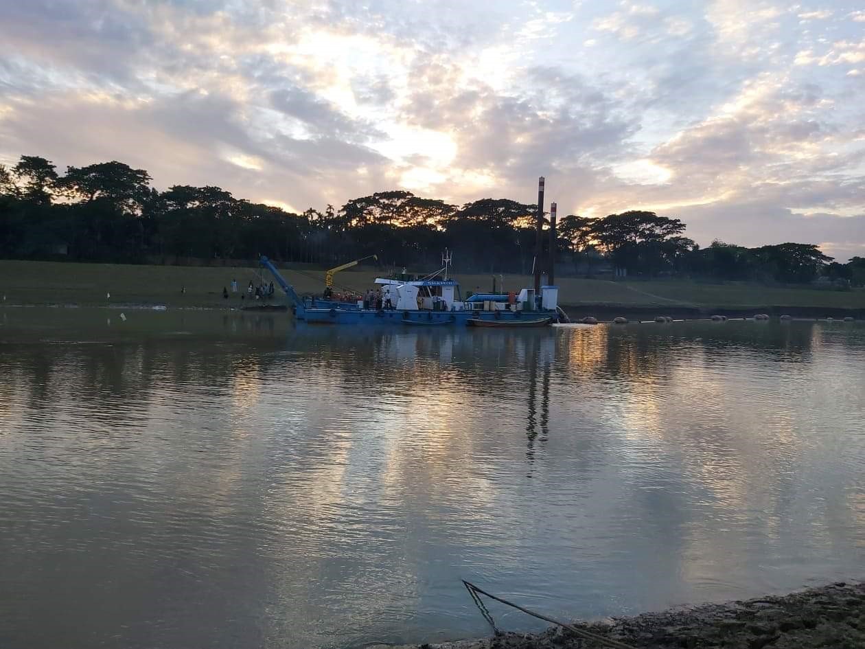
Above Image: Courtesy of BIWTA – Dredging Insepction works

OceanWise was contracted recently by Next Generation Graphics Ltd (NGGL) working for the Bangladesh Inland Water Transport Authority (BIWTA). Established in 1958, BIWTA controls, manages and develops the inland water transport capacity of Bangladesh. NGGL was chosen to supply, install and maintain water level gauges at 53 locations across the inland waterways network including tidal and non-tidal waters. OceanWise was selected to provide the data telemetry, management and visualisation components for the project.

‘Port-Log’, OceanWise’s commercial off-the-shelf environmental monitoring platform, was installed at BIWTA’s offices in Dhaka and is being used to collect, manage and display the data collected from the extensive network of tide gauges. Port-Log is already widely used in the UK and overseas and is particularly popular across the Ports, Harbours and Energy sectors. This project extended Port-Log’s capability to include non-tidal waters. OceanWise also provided consultancy and advice to the project team on sensors, station location, and data acquisition and management.

As part of the project, eight senior members of BIWTA attended a training course in the UK, which included core elements in data management and Port-Log administration, plus guidance on successfully setting up a complete sensor network, including geodetic levelling, sensor calibration, data analysis, data interpretation etc. Training was also provided by Dr Steve Taylor of Geomatix on ‘GeoTide’, which was supplied by OceanWise to provide BIWTA with a tidal analysis and prediction capability for its coastal sites.

A K M Mazibur Rahman, Director of Planning at BIWTA commented “BIWTA decided on Port-Log because it was the best system we had looked at. We have been delighted with our decision and are pleased how well the project has proceeded. We also appreciate all the support and expertise that OceanWise has provided to NGGL throughout the project and the professionalism and hospitality shown to our personnel during the training course“.

Bangladesh is the eighth most populous country in the world, home to nearly 163 million people. The waterways, along with the seaports, make-up a key part of the country’s infrastructure providing important logistic and transportation routes across the country. The country boasts numerous rivers and inland waterways which provide the dominant geographic feature of Bangladesh including the Ganges delta, as well as the combined waters of several other river systems, including the Brahmaputra and Ganges rivers which flow into the Bay of Bengal.
OceanWise’s Managing Director, Dr Mike Osborne, explained: “We were delighted to have been chosen by BIWTA for this important project and have been impressed by how the NGGL and OceanWise project teams have worked together in all aspects of the work. Port-Log provides a comprehensive and scalable platform that will act as a foundation for BIWTA’s environmental monitoring, survey and operational requirements long into the future”.


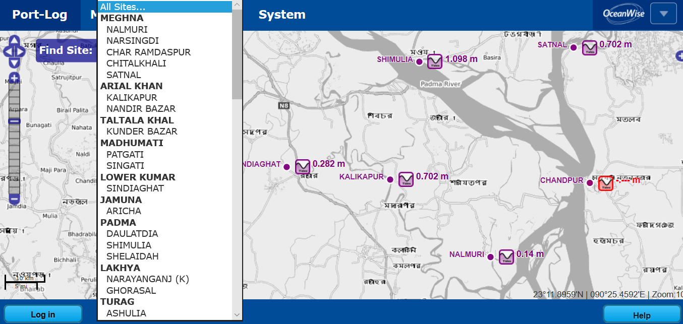
Image above: Port-Log map interface showing site selector, location and water level data

Back to News

News Archive

  • March 2023
  • February 2023
  • January 2023
  • December 2022
  • November 2022
  • October 2022
  • September 2022
  • August 2022
  • July 2022
  • June 2022
  • May 2022
  • April 2022
  • February 2022
  • January 2022
  • December 2021
  • November 2021
  • October 2021
  • September 2021
  • August 2021
  • July 2021
  • June 2021
  • May 2021
  • April 2021
  • March 2021
  • February 2021
  • January 2021
  • December 2020
  • November 2020
  • October 2020
  • September 2020
  • August 2020
  • July 2020
  • May 2020
  • April 2020
  • March 2020
  • February 2020
  • January 2020
  • December 2019
  • November 2019
  • September 2019
  • August 2019
  • July 2019
  • June 2019
  • May 2019
  • April 2019
  • March 2019
  • February 2019
  • January 2019
  • December 2018
  • November 2018
  • October 2018
  • September 2018
  • August 2018
  • July 2018
  • March 2018
  • February 2018
  • December 2017
  • November 2017
  • October 2017
  • September 2017
  • August 2017
  • July 2017
  • May 2017
  • March 2017
  • February 2017
  • January 2017
  • December 2016
  • November 2016
  • October 2016
  • September 2016
  • June 2016
  • May 2016
  • April 2016
  • March 2016
  • January 2016
  • December 2015
  • November 2015
  • October 2015
  • September 2015
  • July 2015
  • June 2015
  • April 2015
  • March 2015
  • February 2015
  • December 2014
  • November 2014
  • October 2014
  • July 2014
  • June 2014
  • September 2012
  • April 2012
  • February 2012
  • December 2011
  • November 2011
  • September 2011
  • August 2011
  • July 2011
  • March 2011

© OceanWise 2023. OceanWise Limited is an independent company specialising in marine environmental data acquisition, management, publishing and GIS.
Registrar of Companies of England and Wales No. 7206926 and Companies Registration Office Ireland No. 641571.

Terms & Conditions | Privacy Notice | Contact Us

OceanWise HelpBot

Still need help?