Oceanwise Logo
LinkedIn Logo Twitter Logo
Log into Port-Log.net
Contact Page
+44 (0) 1420 768262
    • Home
    • About
      • About Us
      • News & Views
      • Events
      • Newsletters
      • Partners
      • Customer Case Studies
      • Professional Bodies
      • Our Team
      • Our Sustainability and Environmental Goals
      • Careers
      • Contact Us
    • Sectors
      • Overview
      • Ports and Harbours
      • Maritime Pilotage
      • Offshore Renewables
      • Governments and Agencies
      • Customer Case Studies
      • Data as Infrastructure
    • Compliance
      • Compliance Overview
      • Marine Data Management
      • Asset Management System (AMS)
      • Aids to Navigation Management System
      • Conservancy Management
      • Spatial Data Management & GIS
      • Environmental Monitoring
      • Our Courses
    • Monitoring
      • Overview
      • Monitoring System Builder
      • Data Management and Display
      • Port-Log
      • Consultancy and Advice
      • Design and Integration
      • Installation and Maintenance
      • Environmental Conditions
    • Mapping
      • Overview
      • Marine Themes Vector
      • Marine Themes DEM
      • ENC Web Map Service
      • Raster Charts
      • Mapping Support
    • Training
      • Our Courses
      • Data Management
      • Data Management for Ports
      • Data Management, Governance and MEDIN toolset
      • Introduction to Change Management
      • Capacity Building
      • Technical Training
      • Product Training
      • Our Workshops
    • Partners
      • Overview
      • Become a Partner
      • Find a Partner
      • The OceanWise Resource Hub
    • Support
      • Resources
      • Portal
      • Support
      • Glossary of Terms
      • Contact Us
      • Terms and Conditions
banner
Marine mapping data that is fit for purpose, in the right format, accurate and up to date

Marine mapping data that is fit for purpose, in the right format, accurate and up to date

Intelligent marine and coastal mapping data

Marine mapping data that is fit for purpose, in the right format, accurate and up to date

Marine mapping data that is fit for purpose, in the right format, accurate and up to date

Intelligent marine and coastal mapping data

Learn More

    Poor data management can put your operations at risk. Read our top tips to achieving marine data management success now.

    By completing this form, you consent to receive marketing and our newsletter emails from OceanWise. To opt out, please email info@oceanwise.eu, or click "unsubscribe" on the email you receive from us. We will not share your contact details with any third party.

Mapping Data FAQs

OceanWise > Mapping Data Overview > Mapping Data FAQs
About our Mapping Data - Frequently asked Questions
Is there a licence that comes with data?
Yes, all data that we supply, either as a dataset or data service, directly, as part of a collective agreement or via one of our Licensed Partners comes with our Standard Terms and Conditions of Licence. This licence defines how the data can be used and the obligations that you have as a user and we have as a supplier. The licence also reflects the terms and conditions that we have to pass on from our data suppliers, such as national Hydrographic Offices.
What does the licence enable me to do?
Our Standard Terms and Conditions of Licence allows you to use the data for internal business use, which includes reproducing and distributing non editable copies of the data in reports, other documents and as image files publicly. The data or any reports or other items containing the data cannot be sold to other parties under this license.

The data cannot be passed on in an editable form to third parties unless there is another agreement in place e.g. when the third party is acting as a contractor and the number of users, including contractor personnel, is covered by the total number of users licensed.

For clarity an organisation creating a report as part of a project for their client is permitted to share the report with the client as that is deemed the internal business use of the organisation. The organisation could not then take that report and sell it to multiple other clients – this would then be deemed commercial gain and not permitted.

Commercial gain would apply where the data is used to create another product which is then sold repeatedly. In this case it may be possible to apply for a low value commercial license so please contact our support team who will be able to advise.

What is a single user licence?
A single user licence allows the data, in whole or in part, to be used by one user concurrently i.e. at any one time. Two different people can access the data as long as they are unable to access the data simultaneously e.g. if there is only one GIS licence available to work on. Single user pricing is also our basic unit of pricing which is multiplied upwards for a greater user numbers.
How long can I licence your data for?
Our standard data licence is for 12 months from the date the data is supplied to you. You may licence the data for longer than this and multi-year discounts are available. Please contact us for details.
How much does your data cost?
Pricing is dependent on the data product provided, the total number of users able to access the data, how users wish to access the data, your area of interest and, in the case of data supplied in dataset form, the maximum scale of data you wish to receive. For data supplied as a data service you receive all scale levels that are available.
How do I order your data and what are your payment terms?
You may order by sending an email to sales@oceanwise.eu. We will invoice your organisation in response to a valid purchase order, or you may request an email with a link to pay by credit card or Paypal. In the latter case, the data will be supplied after confirmation of payment has been received, usually within 24 hours.
Can I give your data to a contractor or a customer?
Yes, you may share the data in whole or in part with a contractor or, if you are a contractor, with your client. However, the same terms and conditions apply and these must be passed on, including the licence number. The contractor, or customer, must not use the data for any purpose other than for fulfilling the terms of the contractual arrangement between you.
Do I need to acknowledge the use of your data?
Yes, our Standard Terms and Conditions of Licence includes a copyright statement which must be clearly displayed on all reproductions of the data, along with the statement ‘Not to be used for Navigation’. In addition, reference must be made to the notices contained in the preface of our Marine and Coastal Data Products User Guide which waives any responsibility that the Data Originator might have in that data.
How can I contact you?
There are several ways to contact us, depending on your preference and the nature of your query. For quotations and all other sales or pre-sales related questions, please complete the Enquiry Form, email us at sales@oceanwise.eu or telephone us during UK office hours on +44 (0) 1420 768262. For support on a product you already hold, or have access to, then please email support@oceanwise.eu, visit the Support Portal or, in the case of an urgent enquiry, telephone us during UK office hours on +44 (0) 1420 768262.
How can I find out more about how your data is created?
Our Marine and Coastal Data Products User Guide includes information on how our data products are created and the differences between them. It also includes details of the limitations in the source data we receive from Hydrographic Offices and other providers which we improve, re-purpose and make fit for purpose for easy use.
In what formats can I get the data provided?
Our datasets are provided in open, industry standard and proprietary formats suitable for all popular GIS software. This includes GML, Esri File Geodatabase (FGDB) and MapInfo TAB. Our data services are provided as OGC compliant web services, such as WMS and WMTS. In addition, we provide supplementary files, such as Esri layer metadata files that ensure the data is ready to use ‘out of the box’.
What Coordinate Reference System is the data provided in?
When Marine Themes Vector and Digital Elevation Model are provided as datasets they are provided in geographic coordinates WGS84 (EPSG:4326). Raster Charts are provided in their original coordinate reference system, usually to the WGS84 Datum (EPSG:4326) and in Mercator or Transverse Mercator, the latter with an individually defined meridian. Raster Charts XL Web Map Tile Service (WMTS) are provided in WGS 84 / Pseudo-Mercator (EPSG:3857) and Raster Charts XL Geotiffs available as World Mercator. Note that, all popular GIS software packages are able to read these directly without the need for any external transformations to be carried out. All depths are to Chart Datum, which in most cases is equal to Low Astronomical Tide (LAT) or Lowest Low Water (LLW) depending on location. On request, we can transform all our datasets to national and other Coordinate Reference Systems of your choice. For our Marine Themes Digital Elevation Model, the data is transformed to Mean Sea level or where appropriate, to a terrestrial datum. Additional charges apply for all projection and/or datum transformations, so please contact us for details.
Can I use your data on a website?
Our Standard Terms and Conditions of Licence allow you to use the data for internal business use, which includes reproducing and distributing non editable copies of the data in reports, other documents and as image files publicly. This includes putting these images on a website either for your own marketing or other purposes or on behalf of a client or customer. Please note restrictions on image size apply.
Can I use the data to create products I can then sell?
Our Standard Terms and Conditions of Licence allows you to use the data for internal business use, which includes reproducing and distributing non editable copies of the data in reports, other documents and as image files publicly. This includes where you are being paid to undertake work for a client or customer. If you wish to supply a product that contains reproductions of the data for money or other commercial gain e.g. advertising revenue, then you will require a commercial licence. This can be arranged for a small fee but for most purposes it is free of charge and lasts for as long as you have a licence to access the data. If the product is an online service or app for which you charge a subscription then please contact us as different rules apply.
Can I use the same data on multiple projects?
Yes, you can use our data on multiple different projects, even if you only have a single user licence, as long as you are not sharing the data with other users, including contractors. To do that, you will require a multi user licence, so please contact us for details and a quotation.
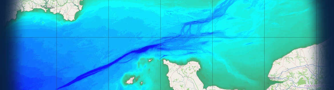
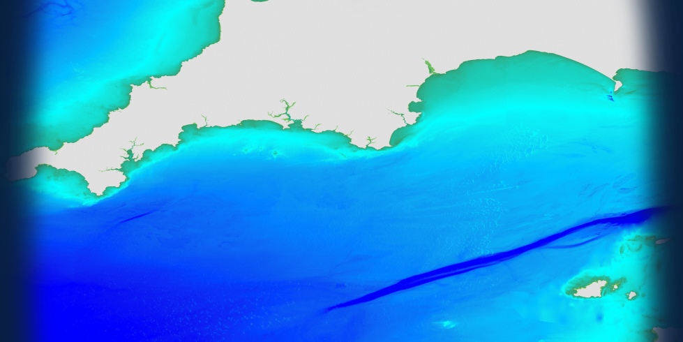
How did OceanWise start creating marine maps?
Please click here for our full mapping story
What do we mean by large scale and small scale?
Scale can often be confusing, see our quick help guide for an explanation
Why do I see data of different scales appear within a single zoom level of a WMTS?
Please find our handy guide here


Why OceanWise?

We are proud to be: Independent. Experienced. Innovative. International. Trusted.

ISO 9001ISO 14001ISO 45001cyberessentials certification

© OceanWise 2023. OceanWise Limited is an independent company specialising in marine environmental data acquisition, management, publishing and GIS.
Registrar of Companies of England and Wales No. 7206926 and Companies Registration Office Ireland No. 641571.

Terms & Conditions | Privacy Notice | Contact Us

OceanWise HelpBot

Still need help?