Contact Us
    • Home
    • About
      • About Us
      • Our Team
      • News & Views
      • Newsletters
      • Events
      • Our Sustainability and Environmental Goals
      • Customer Case Studies
      • Careers
      • Contact Us
    • Industries
      • Overview
      • Ports and Harbours
      • Maritime Pilotage
      • Offshore Renewables
      • Governments and Agencies
      • Customer Case Studies
      • MEMS Framework for UKHO
      • Data as Infrastructure
    • Compliance
      • Compliance Overview
      • Marine Data Management
      • Asset Management System (AMS)
      • Aids to Navigation Management System
      • Conservancy Management
      • Spatial Data Management & GIS
      • Environmental Monitoring
      • Our Courses
    • Monitoring
      • Overview
      • Monitoring System Builder
      • Data Management and Display
      • Port-Log
      • Consultancy and Advice
      • Design and Integration
      • Installation and Maintenance
      • Environmental Conditions
      • Projects
    • Mapping
      • Overview
      • Marine Themes Vector
      • Marine Themes DEM
      • ENC Web Map Service
      • Raster Charts
      • Mapping Support
    • Training
      • Our Courses
      • Data Management
      • Data Management for Ports
      • Data Management, Governance and MEDIN toolset
      • Data Management and Marine Spatial Data Infrastructure (SDI)
      • Technical Training
      • Product Training
    • Partners
      • Licenced Partner Programme
      • Partner’s Resource Hub
    • Support
      • Resources
      • Support
      • Sustainability and Environmental Goals
      • Contact Us
banner
When you need to acquire, manage, use and share marine environmental data

When you need to acquire, manage, use and share marine environmental data

Enjoy the confidence of working with marine data experts

Learn More

When you need to acquire, manage, use and share marine environmental data

When you need to acquire, manage, use and share marine environmental data

Enjoy the confidence of working with marine data experts

Learn More

Ocean Wise News

Do You Know Where Your Tide Gauge Is?

OceanWise > OceanWise News & Views > Uncategorised > Do You Know Where Your Tide Gauge Is?
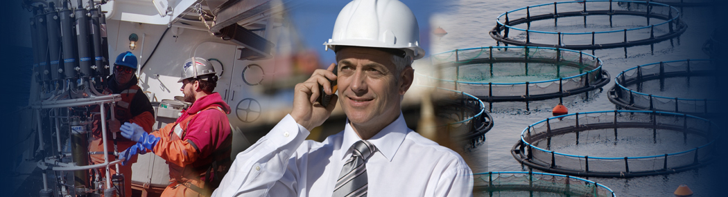
The importance of understanding the relationship between land and sea

Many tide gauges have been established in their current location for several years, some even for centuries! However, their exact location within the three dimensions X, Y and Z or Latitude, Longitude and Orthometric Height, is not always as accurately known as it should be.

With vessel sizes constantly increasing and pressures on knowing exactly how much water there is under the keel, as well as the threat of sea level rise on the UK coastline and storm intensities and frequencies increasing with impacts on the severity on tidal surges and coastal inundation, it is paramount that precise and accurate tidal and water level measurements are observed. This is not only important for real-time operations, but accurate tidal measurements are also essential for improving tidal predictions.

To ensure the accurate measurement of water levels at a specific location we need to establish the precise height of the tide gauge relative a known datum, historically in the UK this is Ordnance Survey Datum Newlyn (ODN). Traditionally this would involve optical levelling of the tide gauge to a known benchmark established in solid rock or on buildings, ideally close to the site. Although benchmarks are established in structures which you don’t typically consider would move, they can be subject to vertical land movement due to slipping of subsiding of the land or structure and thus altering the benchmark’s vertical height. Benchmarks therefore require routine observations to account for any changes in height, however many are not routinely resurveyed to confirm their height. It is also a common occurrence that benchmarks are disturbed by human activity such as removal of structures or new structures being built over them making them inaccessible. Therefore, publicly accessible benchmarks across the UK and their reliability, are diminishing.

So, what is the alternative?

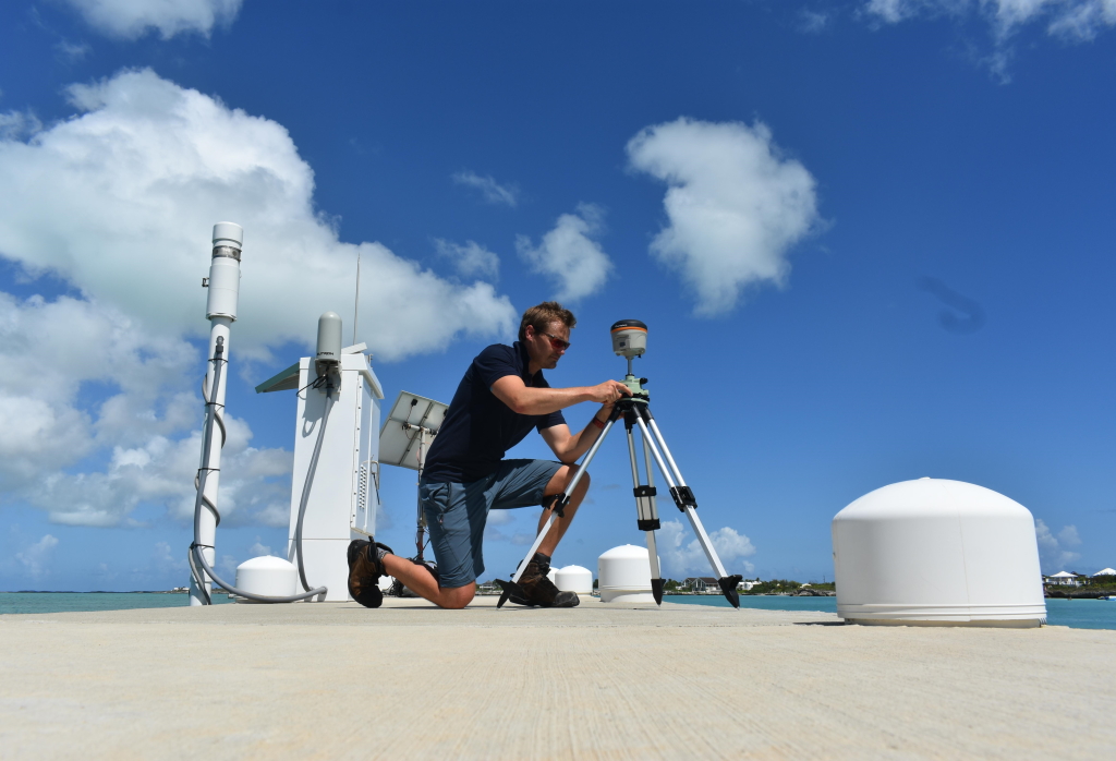
Rather than relying on a previously establish benchmark, advanced geodetic technology such as Global Navigation Satellite System (GNSS) positioning sensors can be used to measure the position of a tide gauge relative to the Earth’s centre. This is where OceanWise can help you. Whether you are installing a tide gauge at a new location, replacing an old tide gauge, or have an established tide gauge which interfaces with your Port-Log platform, OceanWise can assist you by determining exactly where your tide gauge is through a geodetic levelling survey using GNSS technology.

Our team uses GNSS technology to survey either the exact location of your tide gauge if this is possible, or as is often the case, a nearby location height is surveyed and then transferred through optical levelling to the tide gauge. We can establish your own tide gauge benchmark for future surveys or if required, re-survey an existing tide gauge benchmark so that you know exactly where your tide gauge(s) is/are.

How will this benefit you?

As an OceanWise customer we can work with you to determine your GNSS survey requirements and priorities.

The key benefits of tide gauge GNSS surveying are:

  • Improved accuracy in tidal observations
  • Increased confidence in real-time measurements
  • Reliable long-term tidal records for sea-level rise analysis
  • You will know exactly where your tide gauge is!
Back to News

News Archive

  • May 2025
  • April 2025
  • March 2025
  • February 2025
  • January 2025
  • December 2024
  • November 2024
  • October 2024
  • September 2024
  • July 2024
  • June 2024
  • May 2024
  • March 2024
  • February 2024
  • January 2024
  • December 2023
  • November 2023
  • October 2023
  • September 2023
  • August 2023
  • July 2023
  • June 2023
  • May 2023
  • April 2023
  • March 2023
  • February 2023
  • January 2023
  • December 2022
  • November 2022
  • October 2022
  • September 2022
  • August 2022
  • July 2022
  • June 2022
  • May 2022
  • April 2022
  • February 2022
  • January 2022
  • December 2021
  • November 2021
  • October 2021
  • September 2021
  • August 2021
  • July 2021
  • June 2021
  • May 2021
  • April 2021
  • March 2021
  • February 2021
  • January 2021
  • December 2020
  • November 2020
  • October 2020
  • September 2020
  • August 2020
  • July 2020
  • May 2020
  • April 2020
  • March 2020
  • February 2020
  • January 2020
  • December 2019
  • November 2019
  • September 2019
  • August 2019
  • July 2019
  • June 2019
  • May 2019
  • April 2019
  • March 2019
  • February 2019
  • January 2019
  • December 2018
  • November 2018
  • October 2018
  • September 2018
  • August 2018
  • July 2018
  • March 2018
  • February 2018
  • December 2017
  • November 2017
  • October 2017
  • September 2017
  • August 2017
  • July 2017
  • May 2017
  • March 2017
  • February 2017
  • January 2017
  • December 2016
  • November 2016
  • October 2016
  • September 2016
  • June 2016
  • May 2016
  • April 2016
  • March 2016
  • January 2016
  • December 2015
  • November 2015
  • October 2015
  • September 2015
  • July 2015
  • June 2015
  • April 2015
  • March 2015
  • February 2015
  • December 2014
  • November 2014
  • October 2014
  • July 2014
  • June 2014
  • September 2012
  • April 2012
  • February 2012
  • December 2011
  • November 2011
  • September 2011
  • August 2011
  • July 2011
  • March 2011

© OceanWise 2025. OceanWise Limited is an independent company specialising in environmental monitoring solutions, accurate marine mapping data and expert data management services.
Registrar of Companies of England and Wales No. 7206926 and Companies Registration Office Ireland No. 641571.

Terms & Conditions | Privacy Notice | Contact Us

OceanWise HelpBot

Still need help?