Contact Us
    • Home
    • About
      • About Us
      • Our Team
      • News & Views
      • Newsletters
      • Events
      • Our Sustainability and Environmental Goals
      • Customer Case Studies
      • Careers
      • Contact Us
    • Industries
      • Overview
      • Ports and Harbours
      • Maritime Pilotage
      • Offshore Renewables
      • Governments and Agencies
      • Customer Case Studies
      • MEMS Framework for UKHO
      • Data as Infrastructure
    • Compliance
      • Compliance Overview
      • Marine Data Management
      • Asset Management System (AMS)
      • Aids to Navigation Management System
      • Conservancy Management
      • Spatial Data Management & GIS
      • Environmental Monitoring
      • Our Courses
    • Monitoring
      • Overview
      • Monitoring System Builder
      • Data Management and Display
      • Port-Log
      • Consultancy and Advice
      • Design and Integration
      • Installation and Maintenance
      • Environmental Conditions
      • Projects
    • Mapping
      • Overview
      • Marine Themes Vector
      • Marine Themes DEM
      • ENC Web Map Service
      • Raster Charts
      • Mapping Support
    • Training
      • Our Courses
      • Data Management
      • Data Management for Ports
      • Data Management, Governance and MEDIN toolset
      • Data Management and Marine Spatial Data Infrastructure (SDI)
      • Technical Training
      • Product Training
    • Partners
      • Licenced Partner Programme
      • Partner’s Resource Hub
    • Support
      • Resources
      • Support
      • Sustainability and Environmental Goals
      • Contact Us
banner
When you need to acquire, manage, use and share marine environmental data

When you need to acquire, manage, use and share marine environmental data

Enjoy the confidence of working with marine data experts

Learn More

When you need to acquire, manage, use and share marine environmental data

When you need to acquire, manage, use and share marine environmental data

Enjoy the confidence of working with marine data experts

Learn More

Ocean Wise News

Emapsite release new marine data and mapping service

OceanWise > OceanWise News & Views > Uncategorised > Emapsite release new marine data and mapping service

Our Licenced Partner Emapsite who resell our range of marine mapping data have built on the success of their previous marine mapping service and developed a new platform that provides clearer maritime data insights with greater speed and ease than ever before. Read all about it in their press release below: 


Easy-access marine insights

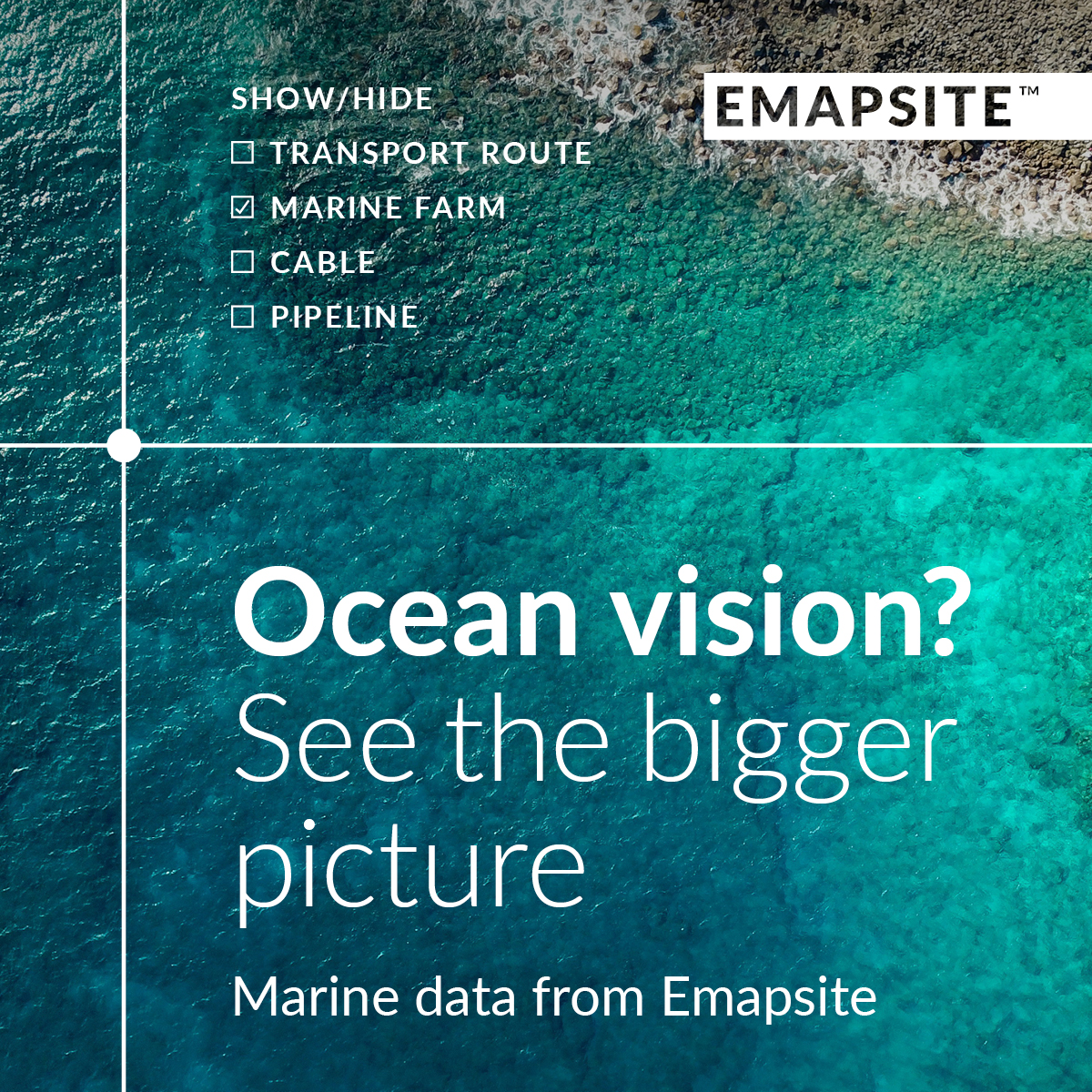
Emapsite Marine is a powerful online platform that provides marine maps and location data for UK waters and beyond. Designed for anyone responsible for developments in the maritime environment, the service facilitates the quick and easy creation of user-defined maps that can pinpoint all known marine infrastructure, surface and geographic features such as shipwrecks, offshore turbines, reefs and pipelines.

Users can simply visit emapsite.com/applications/marine, define an area of ocean, select a relevant combination of dataset layers and then download their custom raster or vector map at the click of a button.

The data available to choose from is up-to-date, accurate, and can uncover an array of maritime insights ranging all the way from elevation, geology, and tides & tidal currents to transport, industrial facilities, and shipwrecks & obstructions. It can also indicate non-physical marine environment considerations such as geographical regions and administrative & management units.

This streamlined process also ensures that customers only pay for the mapped areas and datasets that are relevant to them.

What’s more, the service enables users to order marine mapping that can be combined with land mapping. This advanced capability has been included to enable those who work in connected sea and land environments to see all the insights they require in their Geographic Information System (GIS).

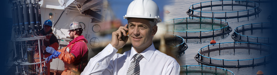
As Rich Pawlyn, Managing Director of Emapsite, says, “Anyone who works in a maritime environment will know that there’s a whole world hidden beneath the waves, and that place is one where accuracy matters.  Governments, offshore renewables, and multi-disciplinary consultancies working with any of those sectors – all need to know exactly what’s going on in the areas of the ocean that they operate in. We’re really excited to be able to offer this vastly updated service. Its capacity to empower people who work in marine environments to gain the insights they need in their specific areas of interest with ease exceeds any other service on the market.”

Dependable data

The data that powers Emapsite’s new marine mapping service is supplied by OceanWise Ltd who take raw data from national Hydrographic offices (like the UK Hydrographic office) and repurpose it into a variety of mapping products for seamless consumption into GIS. The data is regularly updated and checked and as it comes from Hydrographic bodies, it is the most up-to-date and accurate marine location data available.

Caroline Levey, Managing Director of OceanWise, notes: “The breadth and literally depth of data available around marine and coastal environments is incredible. From the location of pipelines, cables and shipwrecks to understanding the changing seabed, this data enables organisations to make smarter and safer decisions.

“Those responsible for planning, managing and operating assets in marine environments understand that mapping and location data needs to be fit for purpose, accurate and up-to-date. Our data ticks all those boxes and more – and Emapsite’s expertise in providing easy access to that information in the right format at the right time takes it to another level.”

Right place, right time

More offshore windfarms, other maritime renewable energy generation projects and marine infrastructures of all kinds are being built, more traffic is flowing across global shipping lanes and calls to protect ocean habitats and ecosystems are growing ever louder. That has produced a time of soaring demand for reliable, tailor-made marine maps.

This greatly enhanced, market-leading offering comes from a firmly established location data company that is considered a leader in its field and has a proven track record of simplifying spatial intelligence. Backed by that expertise, it’s set to revolutionise the ability of people who work at sea – especially those with an interest in connecting sea and land – to navigate today’s increasingly complex maritime world.


Back to News

News Archive

  • May 2025
  • April 2025
  • March 2025
  • February 2025
  • January 2025
  • December 2024
  • November 2024
  • October 2024
  • September 2024
  • July 2024
  • June 2024
  • May 2024
  • March 2024
  • February 2024
  • January 2024
  • December 2023
  • November 2023
  • October 2023
  • September 2023
  • August 2023
  • July 2023
  • June 2023
  • May 2023
  • April 2023
  • March 2023
  • February 2023
  • January 2023
  • December 2022
  • November 2022
  • October 2022
  • September 2022
  • August 2022
  • July 2022
  • June 2022
  • May 2022
  • April 2022
  • February 2022
  • January 2022
  • December 2021
  • November 2021
  • October 2021
  • September 2021
  • August 2021
  • July 2021
  • June 2021
  • May 2021
  • April 2021
  • March 2021
  • February 2021
  • January 2021
  • December 2020
  • November 2020
  • October 2020
  • September 2020
  • August 2020
  • July 2020
  • May 2020
  • April 2020
  • March 2020
  • February 2020
  • January 2020
  • December 2019
  • November 2019
  • September 2019
  • August 2019
  • July 2019
  • June 2019
  • May 2019
  • April 2019
  • March 2019
  • February 2019
  • January 2019
  • December 2018
  • November 2018
  • October 2018
  • September 2018
  • August 2018
  • July 2018
  • March 2018
  • February 2018
  • December 2017
  • November 2017
  • October 2017
  • September 2017
  • August 2017
  • July 2017
  • May 2017
  • March 2017
  • February 2017
  • January 2017
  • December 2016
  • November 2016
  • October 2016
  • September 2016
  • June 2016
  • May 2016
  • April 2016
  • March 2016
  • January 2016
  • December 2015
  • November 2015
  • October 2015
  • September 2015
  • July 2015
  • June 2015
  • April 2015
  • March 2015
  • February 2015
  • December 2014
  • November 2014
  • October 2014
  • July 2014
  • June 2014
  • September 2012
  • April 2012
  • February 2012
  • December 2011
  • November 2011
  • September 2011
  • August 2011
  • July 2011
  • March 2011

© OceanWise 2025. OceanWise Limited is an independent company specialising in environmental monitoring solutions, accurate marine mapping data and expert data management services.
Registrar of Companies of England and Wales No. 7206926 and Companies Registration Office Ireland No. 641571.

Terms & Conditions | Privacy Notice | Contact Us

OceanWise HelpBot

Still need help?