Oceanwise Logo
LinkedIn Logo Twitter Logo
Log into Port-Log.net
Contact Page
+44 (0) 1420 768262
    • Home
    • About
      • About Us
      • News & Views
      • Events
      • Newsletters
      • Partners
      • Customer Case Studies
      • Professional Bodies
      • Our Team
      • Our Sustainability and Environmental Goals
      • Careers
      • Contact Us
    • Sectors
      • Overview
      • Ports and Harbours
      • Maritime Pilotage
      • Offshore Renewables
      • Governments and Agencies
      • Customer Case Studies
      • Data as Infrastructure
    • Compliance
      • Compliance Overview
      • Marine Data Management
      • Asset Management System (AMS)
      • Aids to Navigation Management System
      • Conservancy Management
      • Spatial Data Management & GIS
      • Environmental Monitoring
      • Our Courses
    • Monitoring
      • Overview
      • Monitoring System Builder
      • Data Management and Display
      • Port-Log
      • Consultancy and Advice
      • Design and Integration
      • Installation and Maintenance
      • Environmental Conditions
    • Mapping
      • Overview
      • Marine Themes Vector
      • Marine Themes DEM
      • ENC Web Map Service
      • Raster Charts
      • Mapping Support
    • Training
      • Our Courses
      • Data Management
      • Data Management for Ports
      • Data Management, Governance and MEDIN toolset
      • Introduction to Change Management
      • Capacity Building
      • Technical Training
      • Product Training
      • Our Workshops
    • Partners
      • Overview
      • Become a Partner
      • Find a Partner
      • The OceanWise Resource Hub
    • Support
      • Resources
      • Portal
      • Support
      • Glossary of Terms
      • Contact Us
      • Terms and Conditions
banner
When you need to acquire, manage, use and share marine environmental data

When you need to acquire, manage, use and share marine environmental data

Enjoy the confidence of working with marine data experts

Learn More

When you need to acquire, manage, use and share marine environmental data

When you need to acquire, manage, use and share marine environmental data

Enjoy the confidence of working with marine data experts

Learn More

Ocean Wise News

OceanWise deliver Data Governance and Marine Spatial Data Training as part of the GEOMAC course at the UK Hydrographic Office

OceanWise > OceanWise News & Views > Uncategorised > OceanWise deliver Data Governance and Marine Spatial Data Training as part of the GEOMAC course at the UK Hydrographic Office


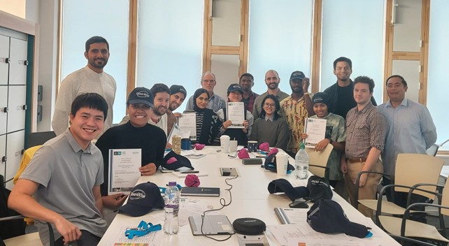
Image above: courtesy of IHO: IHO-Nippon Foundation Alumi Seminar Group Photo

OceanWise’s Dr Mike Osborne, recently delivered a short course as part of the latest Geospatial Marine Analysis and Cartography (GEOMAC) course held at the UK Hydrographic Office in Taunton. The course, ‘Data Governance and Marine SDI’, underlines the importance of data governance in increasing efficiencies and reducing risk when creating and maintaining traditional and e-navigational products and services.

The GEOMAC is a Nippon Foundation funded initiative under the International Hydrographic Organization (IHO) Capacity Building (CB) Programme and is open to individuals from all national hydrographic offices and maritime authorities who wish to expand their knowledge and understanding in this area. The programme “aims to provide an education programme for young nautical cartographers with cutting-edge knowledge and connects the nautical cartography community… The skill and knowledge of this community contributes to solving regional and global challenges beyond the SOLAS obligation”.

Why is data management important to hydrography?

In recent years, the importance of data management to hydrography generally, and as a fundamental building block to marine cartography and source data receipt and assessment, has been highlighted. In addition, the concept of a Marine Spatial Data Infrastructure (MSDI) is increasingly being used to describe how marine geospatial datasets, including hydrographic datasets, are created, and how the data products based on them are maintained and made available to users. Although one of the drivers behind MSDI is to make hydrographic data more readily available for activities unrelated to navigation (e.g. Marine Spatial Planning), it is now accepted that the principles and components that make up MSDI can be applied across all other application areas, including in support of e-navigation.

OceanWise Training

OceanWise was asked to supplement the GEOMAC course by introducing students to data governance theory and practices used in other geographical domains and application areas and how best practice data governance is fundamental to supporting the use of new technologies (e.g. machine learning, autonomous vessels, smart ports) and to making hydrography relevant more widely.

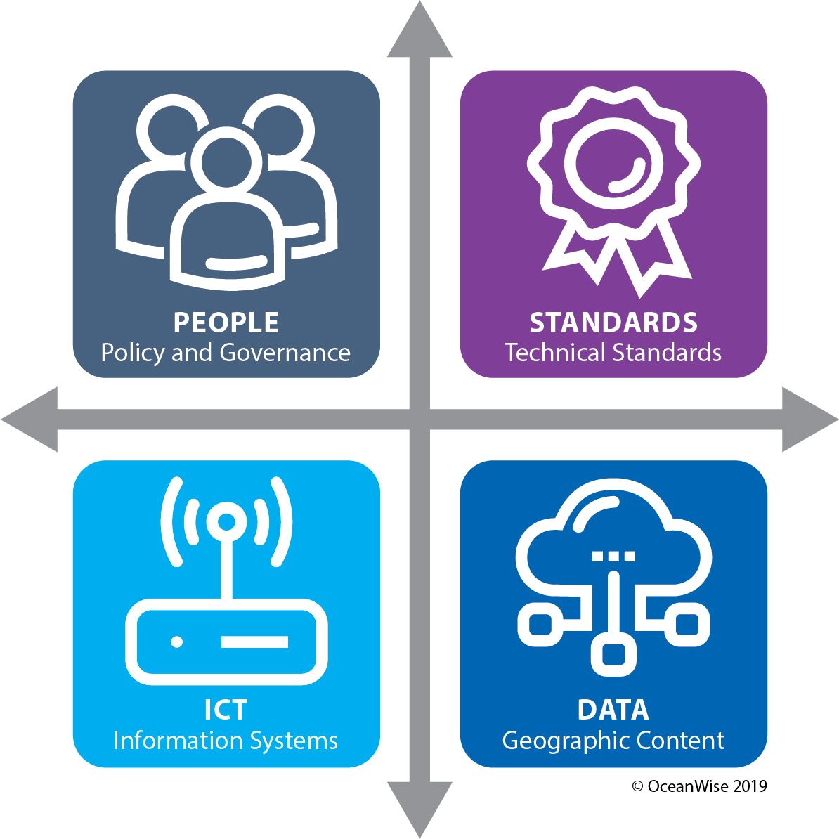
Image above: OceanWise’s 4 pillars of MSDI

The current GEOMAC cohort included students from 15 countries including from West Africa, Middle East, South America and New Zealand. Particularly satisfying was that included in this group were students from IHO member states that have not participated in IHO MSDI related activities previously.

“[The course was] very helpful and opened my vision greatly”; “Instructor was top of his game. Great understanding of the topic and good delivery”; “Thank you for your time and effort – I will use all the knowledge when I return to my country”.

Several examples of student feedback from Dr Mike Osborne training in 2022

For more information on the GEOMAC Project please visit the IHO website here.

For more information on Marine Data Management, MSDI and our training courses please click here

Back to News

News Archive

  • March 2023
  • February 2023
  • January 2023
  • December 2022
  • November 2022
  • October 2022
  • September 2022
  • August 2022
  • July 2022
  • June 2022
  • May 2022
  • April 2022
  • February 2022
  • January 2022
  • December 2021
  • November 2021
  • October 2021
  • September 2021
  • August 2021
  • July 2021
  • June 2021
  • May 2021
  • April 2021
  • March 2021
  • February 2021
  • January 2021
  • December 2020
  • November 2020
  • October 2020
  • September 2020
  • August 2020
  • July 2020
  • May 2020
  • April 2020
  • March 2020
  • February 2020
  • January 2020
  • December 2019
  • November 2019
  • September 2019
  • August 2019
  • July 2019
  • June 2019
  • May 2019
  • April 2019
  • March 2019
  • February 2019
  • January 2019
  • December 2018
  • November 2018
  • October 2018
  • September 2018
  • August 2018
  • July 2018
  • March 2018
  • February 2018
  • December 2017
  • November 2017
  • October 2017
  • September 2017
  • August 2017
  • July 2017
  • May 2017
  • March 2017
  • February 2017
  • January 2017
  • December 2016
  • November 2016
  • October 2016
  • September 2016
  • June 2016
  • May 2016
  • April 2016
  • March 2016
  • January 2016
  • December 2015
  • November 2015
  • October 2015
  • September 2015
  • July 2015
  • June 2015
  • April 2015
  • March 2015
  • February 2015
  • December 2014
  • November 2014
  • October 2014
  • July 2014
  • June 2014
  • September 2012
  • April 2012
  • February 2012
  • December 2011
  • November 2011
  • September 2011
  • August 2011
  • July 2011
  • March 2011

© OceanWise 2023. OceanWise Limited is an independent company specialising in marine environmental data acquisition, management, publishing and GIS.
Registrar of Companies of England and Wales No. 7206926 and Companies Registration Office Ireland No. 641571.

Terms & Conditions | Privacy Notice | Contact Us

OceanWise HelpBot

Still need help?