Oceanwise Logo
LinkedIn Logo Twitter Logo
Log into Port-Log.net
Contact Page
+44 (0) 1420 768262
    • Home
    • About
      • About Us
      • News & Views
      • Events
      • Newsletters
      • Partners
      • Customer Case Studies
      • Professional Bodies
      • Our Team
      • Our Sustainability and Environmental Goals
      • Careers
      • Contact Us
    • Sectors
      • Overview
      • Ports and Harbours
      • Maritime Pilotage
      • Offshore Renewables
      • Governments and Agencies
      • Customer Case Studies
      • Data as Infrastructure
    • Compliance
      • Compliance Overview
      • Marine Data Management
      • Asset Management System (AMS)
      • Aids to Navigation Management System
      • Conservancy Management
      • Spatial Data Management & GIS
      • Environmental Monitoring
      • Our Courses
    • Monitoring
      • Overview
      • Monitoring System Builder
      • Data Management and Display
      • Port-Log
      • Consultancy and Advice
      • Design and Integration
      • Installation and Maintenance
      • Environmental Conditions
    • Mapping
      • Overview
      • Marine Themes Vector
      • Marine Themes DEM
      • ENC Web Map Service
      • Raster Charts
      • Mapping Support
    • Training
      • Our Courses
      • Data Management
      • Data Management for Ports
      • Data Management, Governance and MEDIN toolset
      • Introduction to Change Management
      • Capacity Building
      • Technical Training
      • Product Training
      • Our Workshops
    • Partners
      • Overview
      • Become a Partner
      • Find a Partner
      • The OceanWise Resource Hub
    • Support
      • Resources
      • Portal
      • Support
      • Glossary of Terms
      • Contact Us
      • Terms and Conditions
banner
When you need to acquire, manage, use and share marine environmental data

When you need to acquire, manage, use and share marine environmental data

Enjoy the confidence of working with marine data experts

Learn More

When you need to acquire, manage, use and share marine environmental data

When you need to acquire, manage, use and share marine environmental data

Enjoy the confidence of working with marine data experts

Learn More

Ocean Wise News

New Environmental Monitoring systems at two key Ghana Ports

OceanWise > OceanWise News & Views > Uncategorised > New Environmental Monitoring systems at two key Ghana Ports

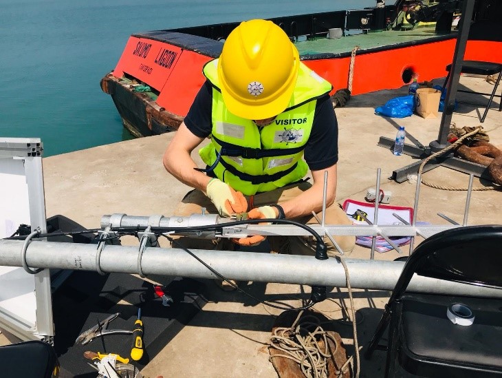
Above image: OceanWise field engineer working on installations at Tema Port

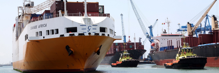
OceanWise has recently been involved in a project with Ghana Ports and Harbours Authority (GPHA) – dubbed as “the trade and logistics hub of Western Africa”. The project, which was a collaborative effort between OceanWise and our Licensed Partner Brewzone Ventures Ltd, involved installing a comprehensive environmental monitoring system at two key GPHA ports: Tema and Takoradi.

The tide and weather system is designed to deliver essential real-time tide and weather data to the GPHA operators, hydrographers and pilots who will rely on the data to make important operational decisions and ensure safety at the port. The data from the tide and weather stations is collected, managed and published in the OceanWise data publishing platform Port-Log which delivers reliable, secure data to those who need it, when they need it.

Not only do the tide gauges provide data to GPHA, they also form part of the GLOSS network (Global Sea Level Observing System). GLOSS was established by the Intergovernmental Oceanographic Commission (IOC) of UNESCO in 1985 to establish a well-designed, high-quality in situ sea level observing network to support a broad research and operational user base. The two tide gauges at Tema and Takoradi are part of over 300 gauges that make up this important data network.

Following a successful visit by GPHA to the UK, the fully tested system which included two tide and weather stations, was shipped to Ghana where two OceanWise field engineers worked alongside our partner Nana Brew of Brewzone and GPHA, to install the equipment, train the local teams and oversee the integration of the equipment and data into GPHA’s existing systems. The site visit included establishing a network of benchmarks, with the aim of being able to tie the new data to one of the longest sea level datasets in Africa dating back to the 1920s.

Yirenkyi Koranteng (Isaac), Port Hydrographer for GPHA comments: “We were pleased that OceanWise were able to deliver an operational system which is also contributing to global sea level measurement. OceanWise’s experience of working with many ports is helping GPHA deliver our goals and this is much appreciated“.

This project is just one of the many improvements that GPHA are making and goes some way to helping them achieve their visions which include “reducing the cost of trade, providing and maintaining efficient modern Port facilities, aiding in regional development and providing and maintaining safe and secure sea ports for the nation and sub region”.

With 85% of Ghana’s trade arriving and departing via the ports, it’s clear that they represent a very important part of the country’s infrastructure and OceanWise are very proud to have been a part of this important project, alongside Brewzone and the UK’s National Oceanography Centre (NOC). Following this project, OceanWise is “looking forward to continuing to work closely with Brewzone to develop other exciting opportunities in the Western Africa region. Nana Brew, Managing Director of Brewzone has been fundamental in helping OceanWise secure and deliver this project and we look forward to working with him moving forward on other projects and maintaining our positive relationship with GPHA”.

Above image source: https://www.ghanaports.gov.gh/

Back to News

News Archive

  • March 2023
  • February 2023
  • January 2023
  • December 2022
  • November 2022
  • October 2022
  • September 2022
  • August 2022
  • July 2022
  • June 2022
  • May 2022
  • April 2022
  • February 2022
  • January 2022
  • December 2021
  • November 2021
  • October 2021
  • September 2021
  • August 2021
  • July 2021
  • June 2021
  • May 2021
  • April 2021
  • March 2021
  • February 2021
  • January 2021
  • December 2020
  • November 2020
  • October 2020
  • September 2020
  • August 2020
  • July 2020
  • May 2020
  • April 2020
  • March 2020
  • February 2020
  • January 2020
  • December 2019
  • November 2019
  • September 2019
  • August 2019
  • July 2019
  • June 2019
  • May 2019
  • April 2019
  • March 2019
  • February 2019
  • January 2019
  • December 2018
  • November 2018
  • October 2018
  • September 2018
  • August 2018
  • July 2018
  • March 2018
  • February 2018
  • December 2017
  • November 2017
  • October 2017
  • September 2017
  • August 2017
  • July 2017
  • May 2017
  • March 2017
  • February 2017
  • January 2017
  • December 2016
  • November 2016
  • October 2016
  • September 2016
  • June 2016
  • May 2016
  • April 2016
  • March 2016
  • January 2016
  • December 2015
  • November 2015
  • October 2015
  • September 2015
  • July 2015
  • June 2015
  • April 2015
  • March 2015
  • February 2015
  • December 2014
  • November 2014
  • October 2014
  • July 2014
  • June 2014
  • September 2012
  • April 2012
  • February 2012
  • December 2011
  • November 2011
  • September 2011
  • August 2011
  • July 2011
  • March 2011

© OceanWise 2023. OceanWise Limited is an independent company specialising in marine environmental data acquisition, management, publishing and GIS.
Registrar of Companies of England and Wales No. 7206926 and Companies Registration Office Ireland No. 641571.

Terms & Conditions | Privacy Notice | Contact Us

OceanWise HelpBot

Still need help?