Mapping Data Buying Guide
How to buy accurate and up to date marine and coastal mapping data to suit all your needs
The variety of data themes, formats, delivery methods, pricing and licensing terms make acquiring any type of data a complicated process. This is particularly true for marine data which is available in various formats, coordinate reference systems and with varying content.
We want to make it as easy and straightforward as possible for you to choose the right data for your needs. Take some time to read more about how we can help you to make the right decisions.
Select your organisation from the type below to learn more:
Commercial:
Read more
We have a network of Licensed Partners who resell our data products, either as datasets or data services. If your needs are straightforward, obtaining our data via a Licensed Partner is likely to be your best option; this has the added benefit that many of our Licensed Partners also offer value-added services. See the Find A Partner page to find an appropriate Licensed Partner. Please contact us directly if your needs are more complex or you need help in making the right decision. We are always happy to receive comments about your experiences, whether positive or otherwise, when obtaining data initially and at your licence renewal time.
Government:
Read more
We licence our data to central government departments, non-departmental public bodies and agencies, either directly or via a collective mapping framework agreement where one organisation takes the lead. Please contact us to find out if your organisation is already part of a collective agreement, is eligible to join one or to arrange a direct licence. Our data offers great value, plus all government organisations qualify for a 40% discount on our commercial pricing, so the cost of obtaining a licence may be less than you think.
Academia & NGOs:
Read more
Special licensing terms can apply where our data is used for education and publicly funded research, so please contact us for details. Non-Government Organisations (NGOs) may also qualify, so contact us . Please provide as much detail as possible on how the data will be used and for how long.
I want to resell your data / integrate your data into my product:
Read more
If you wish to resell our data to your customers to support an ongoing project, handover a data package at the end of a project or where you require a marine base map in a product or service, then your best option might be to join our extensive network of Licensed Partners. We have different categories and levels of reseller agreement so it’s likely we will be able to meet your exact requirements. To find out more contact us or visit our Licensed Partner page.
Want to try out our data?
Read more
All our datasets, except for the ENC Web Map Service, are available as sample data files for the area around Milford Haven, Wales. The data are available in various formats suitable for most GIS applications, ready for you to load, assess and confirm it meets your needs. With our sample data, you will also receive our ‘Marine and Coastal Data Products Guide’ which provides detailed information on our datasets and their usage. Our datasets are also available as web services, please contact us if you would like try one of our data services in your desktop or web application.
Still unsure about the data you need?
Please find some helpful FAQ’s below
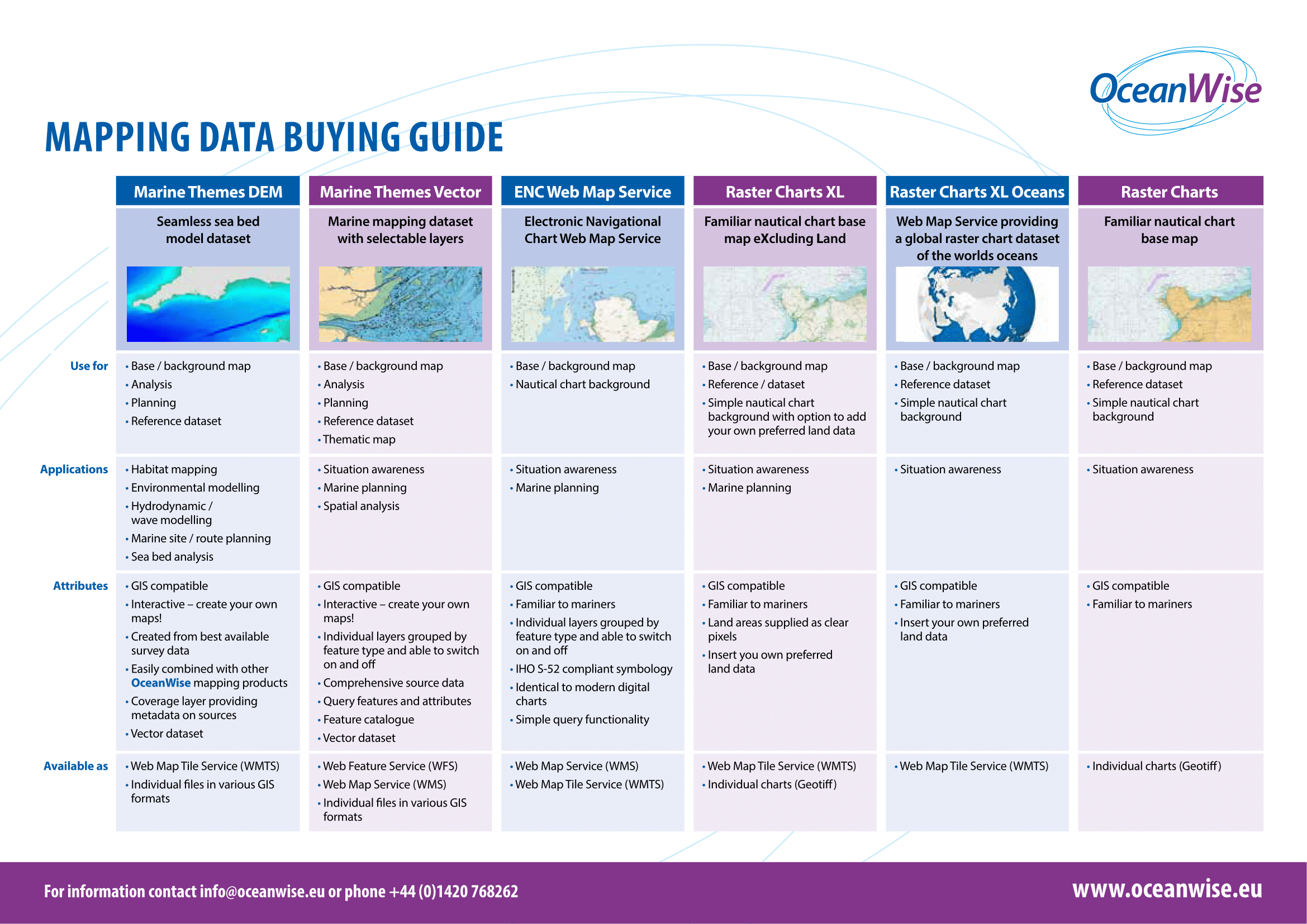
How do I know which product is best for my needs?
First thing to decipher is whether you need a background map OR an interactive map. Do you need to manipulate or analyse the data?
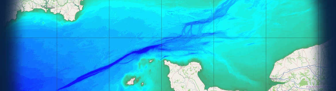
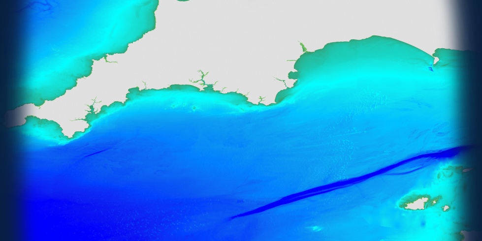
For background mapping, our Raster Charts or Raster Charts XL will likely be the right product. Raster Charts are essentially digital versions of nautical paper charts. They are ideal for reference, site selection, feasibility, context and background mapping purposes. Raster Charts are available either with or without land features. Raster Charts XL (eXcluding Land) is ideal when you wish to combine and use marine and coastal data with your own or other land mapping data.
If you want to manipulate and edit the data, in for example, a GIS (Geographic Information System), then our Marine Themes Vector data is required. Find out more about the difference between Raster and Vector data by visiting our Raster Charts, Raster Charts XL and Marine Themes Vector pages.
Do I need a dataset OR web map service?
The answer will depend on how you want the data to be delivered and managed
I need to integrate data into a software package for analysis and editing = you’ll need a dataset that can be downloaded, stored and managed on your own server.
I need mapping to use in a web application / as a background map (non-editable) that is easy to share = you need one of our data services.
How often do you need the data updated?
Our datasets are updated every quarter. Our data services are regularly updated to ensure you always have the latest mapping content.
What geographical coverage do you require?
We provide small scale Raster Chart and Marine Themes data coverage worldwide. We also have extensive coverage of larger scale Raster Chart and Marine Themes data in Europe, the Middle East and many other parts of the world. Our ENC Web Map Service coverage is worldwide.
How many people are going to use the data and for what purposes?
The licensing of the data can be quite complex, and is dependent on the number of people using the data and the purpose for which the data is to be used. Read our Standard Terms and Conditions of Licence for more information. If you have questions please see our Data FAQs or contact us.