Oceanwise Logo
LinkedIn Logo Twitter Logo
Log into Port-Log.net
Contact Page
+44 (0) 1420 768262
    • Home
    • About
      • About Us
      • News & Views
      • Events
      • Newsletters
      • Partners
      • Customer Case Studies
      • Professional Bodies
      • Our Team
      • Our Sustainability and Environmental Goals
      • Careers
      • Contact Us
    • Sectors
      • Overview
      • Ports and Harbours
      • Maritime Pilotage
      • Offshore Renewables
      • Governments and Agencies
      • Customer Case Studies
      • Data as Infrastructure
    • Compliance
      • Compliance Overview
      • Marine Data Management
      • Asset Management System (AMS)
      • Aids to Navigation Management System
      • Conservancy Management
      • Spatial Data Management & GIS
      • Environmental Monitoring
      • Our Courses
    • Monitoring
      • Overview
      • Monitoring System Builder
      • Data Management and Display
      • Port-Log
      • Consultancy and Advice
      • Design and Integration
      • Installation and Maintenance
      • Environmental Conditions
    • Mapping
      • Overview
      • Marine Themes Vector
      • Marine Themes DEM
      • ENC Web Map Service
      • Raster Charts
      • Mapping Support
    • Training
      • Our Courses
      • Data Management
      • Data Management for Ports
      • Data Management, Governance and MEDIN toolset
      • Introduction to Change Management
      • Capacity Building
      • Technical Training
      • Product Training
      • Our Workshops
    • Partners
      • Overview
      • Become a Partner
      • Find a Partner
      • The OceanWise Resource Hub
    • Support
      • Resources
      • Downloads
      • Portal
      • Support
      • Glossary of Terms
      • Contact Us
      • Terms and Conditions
banner
Marine mapping data that is fit for purpose, in the right format, accurate and up to date

Marine mapping data that is fit for purpose, in the right format, accurate and up to date

Intelligent marine and coastal mapping data

Marine mapping data that is fit for purpose, in the right format, accurate and up to date

Marine mapping data that is fit for purpose, in the right format, accurate and up to date

Intelligent marine and coastal mapping data

Learn More

    Poor data management can put your operations at risk. Read our top tips to achieving marine data management success now.

    By completing this form, you consent to receive marketing and our newsletter emails from OceanWise. To opt out, please email info@oceanwise.eu, or click "unsubscribe" on the email you receive from us. We will not share your contact details with any third party.

Raster Charts eXcluding Land (XL)

OceanWise > Mapping Data Overview > Raster Charts eXcluding Land (XL)
Familiar nautical chart basemap, ready for immediate use in GIS or other applications

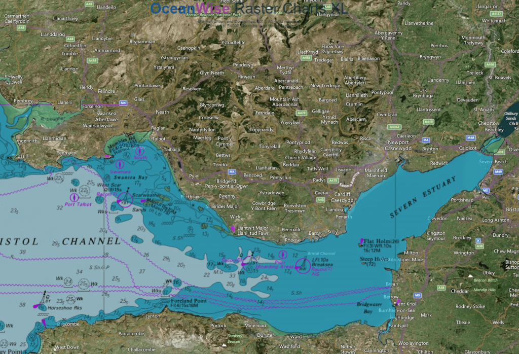
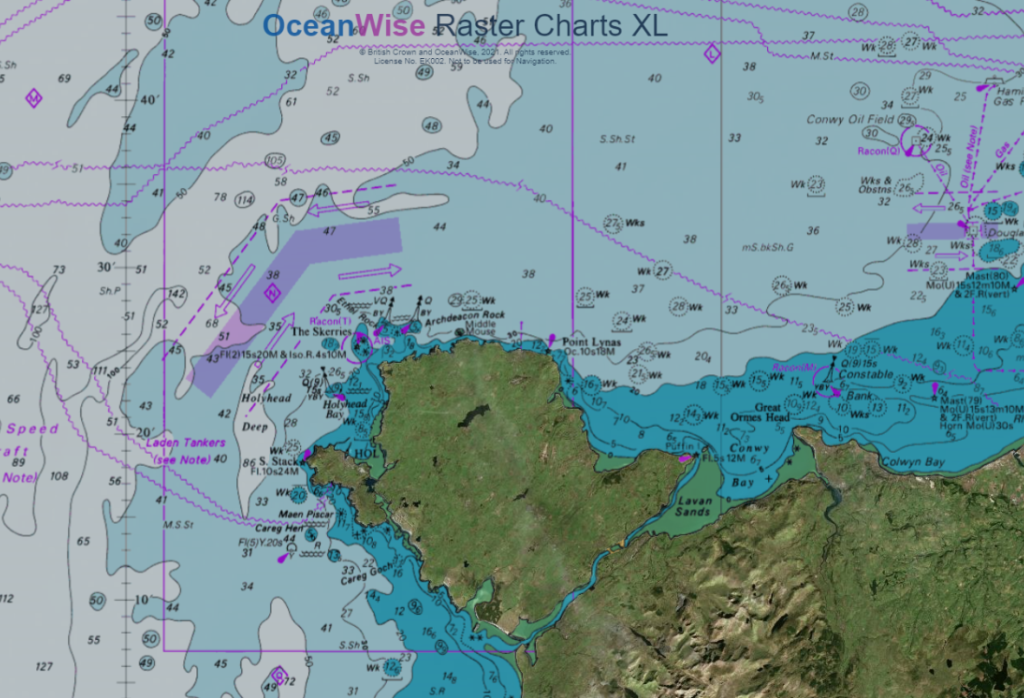
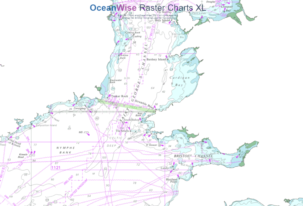
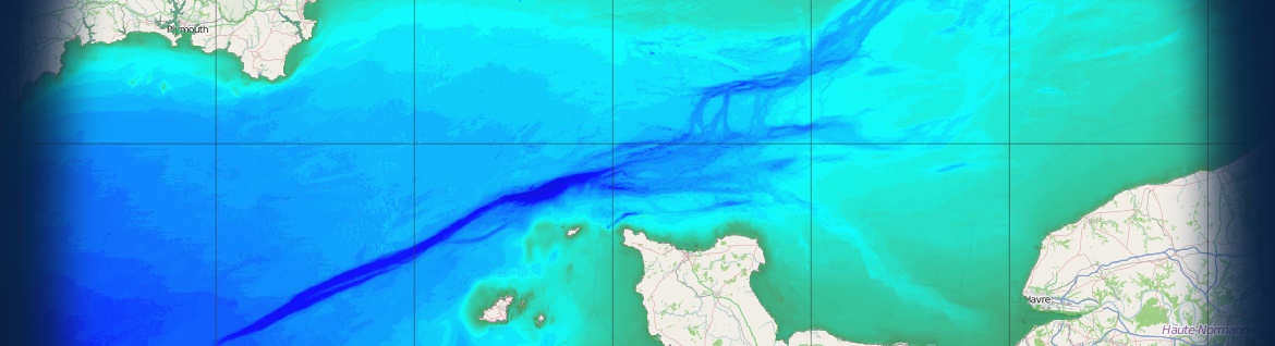
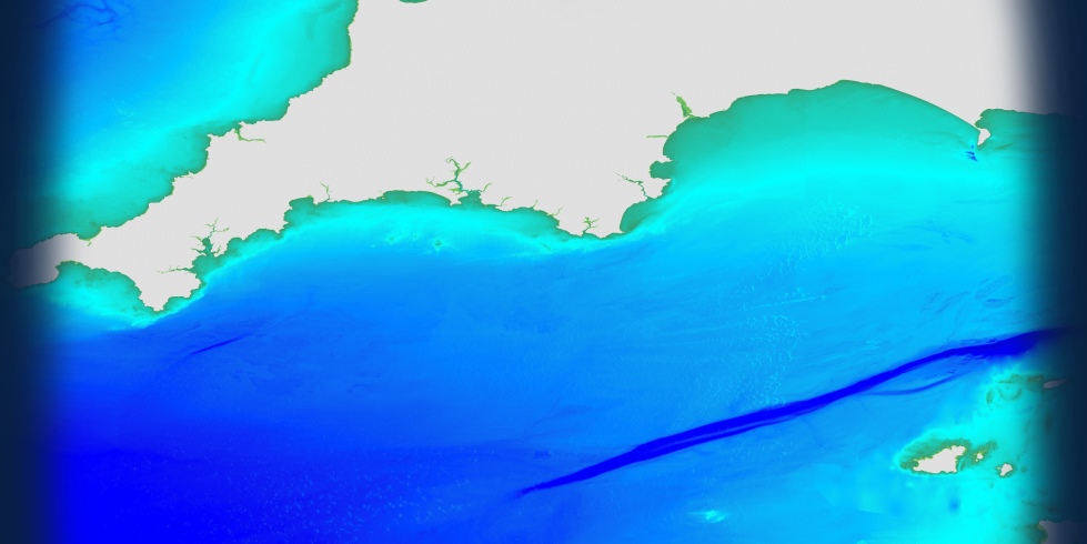
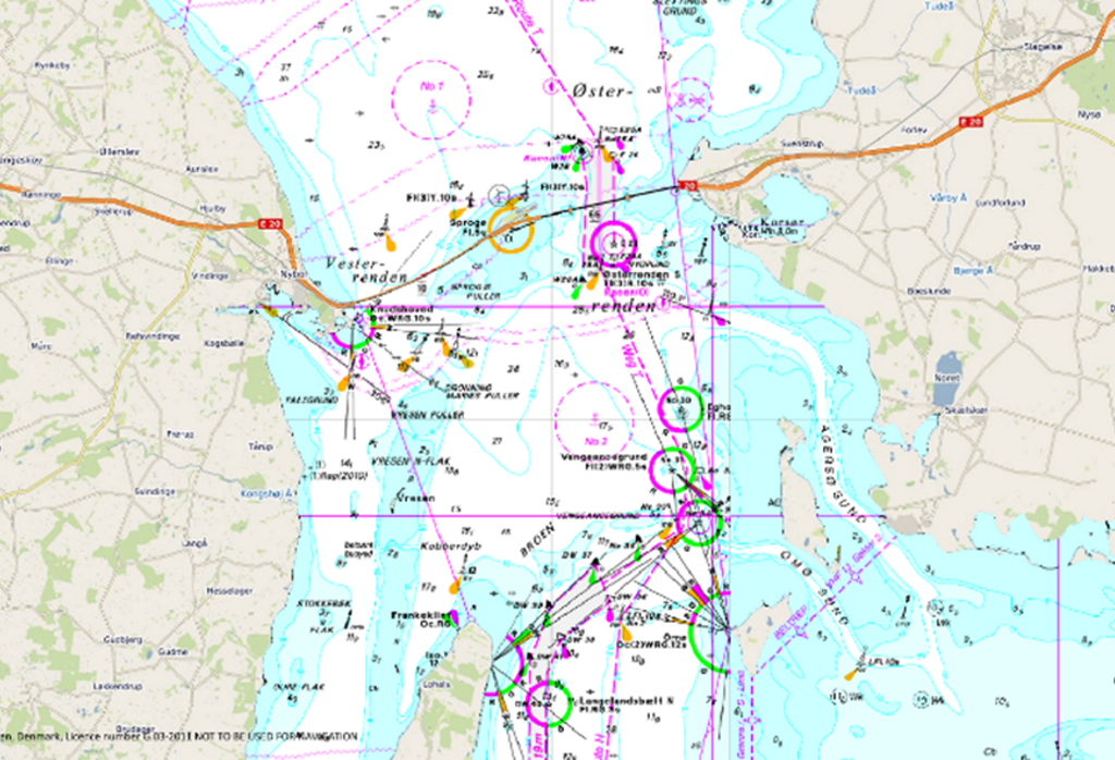
Raster Charts eXcluding Land (RCXL) are electronic versions of the familiar nautical paper charts and ideal for use as a base map or simple nautical chart background. These charts have had the land removed and are ready to be paired with the users preferred land mapping dataset (Google Maps, OpenStreetMaps, Bing, etc.).

Raster Charts contain all the same information as paper charts including, for example, depth soundings, buoy numbers, basic land features etc. Providing familiarity for users who work with nautical charts and pre-symbolised so that they are ready for immediate use in GIS or other applications.


Read more

Raster Charts XL are perfect for those looking to add a familiar authoritative source to proposals, GIS projects and Web Mapping Applications.

RCXL are ideal for use as a:
  • Base / Background Map
  • Reference Dataset
  • Simple nautical chart background with your own preferred land data
Technical Details
  • Easily opened using any image viewer software
  • Available as individual charts or as a Web Map Tile Service
  • Supplied in GIS compatible file formats (GeoTiff)
  • Land based features carefully ‘snipped’ out and supplied as clear pixels
  • Available for consumption quickly after purchase with no complicated setup or wait period
  • Current coverage: UK, France, Belgium, Netherlands, Germany, Denmark, Sweden and the Arabian Gulf
  • Availability is dependent on permissions granted by contributing nations worldwide
  • OceanWise obtain Raster Charts under licence from the UK, and other, Hydrographic Offices
Why have we eXcluded Land (XL)?

Land mapping datasets tend to fill bodies of water with a shade of blue, because maritime information isn’t useful for the majority of their users. In the same vein, Nautical Charts fill land with a mustard shade. These datasets are suitable for someone navigating a car, or a ship, but what happens when your use case requires harmonised land and maritime information? RCXL is developed to solve this exact issue.


Read more

By removing the land from Nautical Charts, users are now able to combine the useful aspects of both datasets for a harmonious mapping experience across land and sea. Finally, as Nautical Charts are designed without any context of the surrounding charts, land from one chart will often overlap valid maritime data from another – a by-product of removing the land is that issue is also resolved in RCXL.

Do you want to try it out for yourself? Please see all our mapping products on our demo site here.

How much do they cost / how do I buy?

Raster Charts XL can be supplied as individual charts or as a Web Map Tile Service (WMTS). Prices vary depending on the area of interest, service and scale required.


Read more

Commercial customers can purchase our mapping products via our Licensed Partners who resell our data products. Click on any of our mapping partners below to be redirected to their website or for more details, see our Find A Partner page.

Please contact us directly if your needs are more complex or you need help in choosing the most appropriate product. See our Data Buying Guide

For Government, Academia & NGOs customers please contact OceanWise directly. All government organisations qualify for a discount and special licensing terms can apply where our data is used for education and publicly funded research, so please contact us for a quote.

Click on below logos

emapsite
Find_Maps
Europa_Technologies

DigiMap_Jersey
DigiMap_Guernsey

Learn More

  • OceanWise Mapping Demo
  • Mapping Data FAQs
  • Marine Themes Vector
  • Raster Charts XL Oceans
  • Mapping Data Buying Guide
  • Mapping Data Products Brochure
  • What Is Your Data Challenge?

SeaRoc

OceanWise's data helps us solve complex challenges - we couldn't manage without it. They provide us with data of great quality and accuracy which helps us pitch our product to a global market.

Dominic Stratton - Business Development Manager

Lloyd's Register

Other suppliers may have the raw data but they haven't solved the big problem of joining all those hydrographic charts together - that's the value of the OceanWise product

Sam Franklin - IRIS & Web Services Product Manager

Why OceanWise?

We are proud to be: Independent. Experienced. Innovative. International. Trusted.

ISO 9001ISO 14001ISO 45001cyberessentials certification

© OceanWise 2023. OceanWise Limited is an independent company specialising in marine environmental data acquisition, management, publishing and GIS.
Registrar of Companies of England and Wales No. 7206926 and Companies Registration Office Ireland No. 641571.

Terms & Conditions | Privacy Notice | Contact Us

OceanWise HelpBot

Still need help?